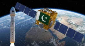
Pakistan is taking a giant leap forward in space technology. The country is set to launch its first-ever Hyperspectral Satellite, named HS-1, on October 19th from a launch center in China. This isn’t just another satellite; it’s a powerful new tool that will provide a super-human view of the Earth, offering major benefits for farmers, city planners, and disaster management teams.
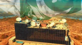
Managed by Pakistan’s space agency, SUPARCO, the HS-1 satellite uses advanced “hyperspectral imaging.” Think of it as seeing the world in hundreds of colors that our eyes can’t perceive. This allows it to detect subtle details about soil health, water stress in crops, and even mineral deposits from space.
Pakistan Launches Satellite-Powered Telemedicine System ‘Sky Clinic’
For a country like Pakistan, where agriculture is a backbone of the economy, this is a game-changer. The satellite’s data can help farmers practice precision agriculture, potentially boosting crop yield estimates by up to 20% and ensuring resources like water and fertilizer are used optimally. Furthermore, the HS-1 will be a vital asset for predicting floods, monitoring landslides, and assessing environmental changes, making the nation more resilient to natural disasters. This mission is a key part of SUPARCO’s long-term Vision 2047, proving Pakistan’s serious commitment to using space for national development.
Frequently Asked Questions (FAQs)
1. What is so special about a hyperspectral satellite?
Unlike regular cameras that see basic colors, a hyperspectral sensor captures a very wide spectrum of light. This lets it identify unique “fingerprints” for different materials, like a specific crop disease or a type of rock, which is impossible with standard satellite imagery.
2. How will the HS-1 satellite help Pakistani farmers?
It will provide detailed data on soil moisture, nutrient levels, and plant health. This allows for precision farming, meaning farmers can apply water and fertilizer only where and when needed, reducing waste and increasing crop yields significantly.
3. Can this satellite predict natural disasters?
While it can’t predict earthquakes, it is excellent for monitoring conditions that lead to other disasters. It can track soil saturation to help predict floods, monitor ground movement for landslide risks, and map coastal changes.
4. Is this Pakistan’s first satellite?
No, Pakistan has launched other satellites like PRSS-1 and PakTES-1A. The HS-1 is special because it is the country’s first hyperspectral satellite, representing a significant technological upgrade in its space capabilities.
5. Why is Pakistan launching the satellite from China?
International collaboration is common in space exploration. China has a well-established launch infrastructure, making it a reliable and efficient partner for countries like Pakistan to get their satellites into orbit.